


Main //
Region
Region
Luninetsky district was established on January 15, 1940. It is located in the east of the Brest region in the zone of the Belarusian Polesie. It borders Pinsky in the west, Stolinsky in the south, Gantsevichi districts of Brest region in the north, Soligorsky district of Minsk and Zhitkovichi of Gomel regions in the east.
Luninetsky district is one of the three districts of the Brest region most severely affected by the Chernobyl accident in 1986. 2/3 of the territory with a pollution density from 1 to 5 curies per square kilometer is polluted.
The territory of the district is 2.7 thousand square kilometers. The length from west to east is 73 kilometers, from north to south – 65 kilometers. About 40 percent of the territory is occupied by forests.
Administratively, it is divided into the towns of Luninets and Mikashevichi, rural settlements. The district center is the city of Luninets.

63 thousand 464 people live in 82 settlements, including urban – 36,096 people, rural – 27,368 people. The working–age population is 34,823 people, including urban – 20,404 people, rural – 14,419 people.
The national composition of the population is represented by Belarusians – 96.2%, Russians – 2.5%, Ukrainians – 0.8%. 0.5% are other nationalities.
The highest place above the Baltic Sea level is 152 m, the lowest is 128 m. Minerals: granite, peat, sand, clay, sapropel.
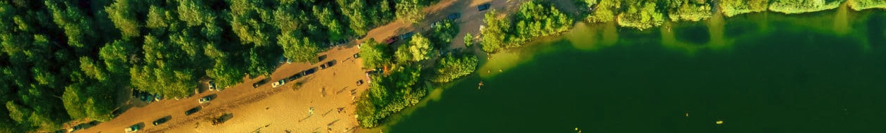
The rivers Pripyat, Tsna, Bobrik, Volkhva, Lan, Smerd flow through the territory of the district, the channels Volchansky, Luninetsky, and the Mikashevichsky shipping channel are built. The largest lakes are Beloe, which is the center of the republican reserve, Chernoe and Vulkovskoye. The water reclamation system of the district is fed by two reservoirs - Velutskoye and Sobelskoye.


ONLINE RESOURCES